Wondering what Vegrún actually is, so here’s the short version.
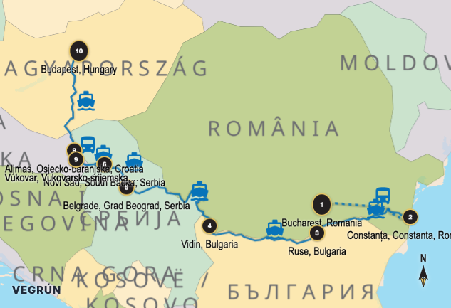
It’s a mapping tool for the whole journey, not just the destinations. Most maps (like Google Maps) are great for getting from A to B, but terrible at showing a complex A-to-B-to-C-to-D trip across multiple countries and transport modes. Vegrún fixes that.
You add stops — by searching or just clicking the map. Then you pick how you’re getting between them: flight, train, bus, ferry, car, bike, or hike. Every leg gets stitched together on a single, interactive map. The result looks something like this:
It’s for backpackers taking the long way across continents. Sailors and hikers who have GPS tracks that deserve a better home than a spreadsheet. Anyone who wants to see their trip as a story, not a list of cities.
Once the map is built, you can export it as a social media card, a high-res image, or share a link to the interactive version.
I’m building it because I want it — I kept running into this problem on my own trips, and nothing out there handled ferries, river routes, and off-road tracks in one place. So I’m making the thing I wish existed.
More updates soon.
#TravelMap #RoutePlanning #TravelTech #Mapping #Vegrún